We spent last night in an exotic “cave hotel,” where the rooms are carved out of the hillside, and lived much like the ancients did. Of course, those early inhabitants did not have lights, indoor plumbing nor internet, but we were only willing to go so far in “roughing it.” ☺
Yesterday, we pored over the map to see where we were going today. We finally concluded that it was not a very good map, since Cappadocia was not even shown on it! Mehmet then informed us that Cappadocia is an informal and mostly tourist name, not the name of any city nor even an official name of the region.
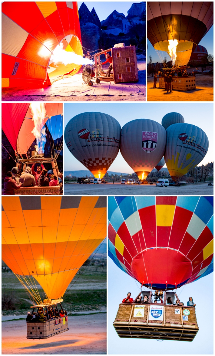
We got up well before dawn, to head to the area where hot air balloons are launched each morning when the air is sufficiently calm. We have photographed balloon ascensions in Albuquerque, NM in the past, and even rode in hot air balloons in Napa, California. We still find it fascinating to walk the grounds as the pilots fire up the propane burners to provide the hot air to lift the balloons into the air.
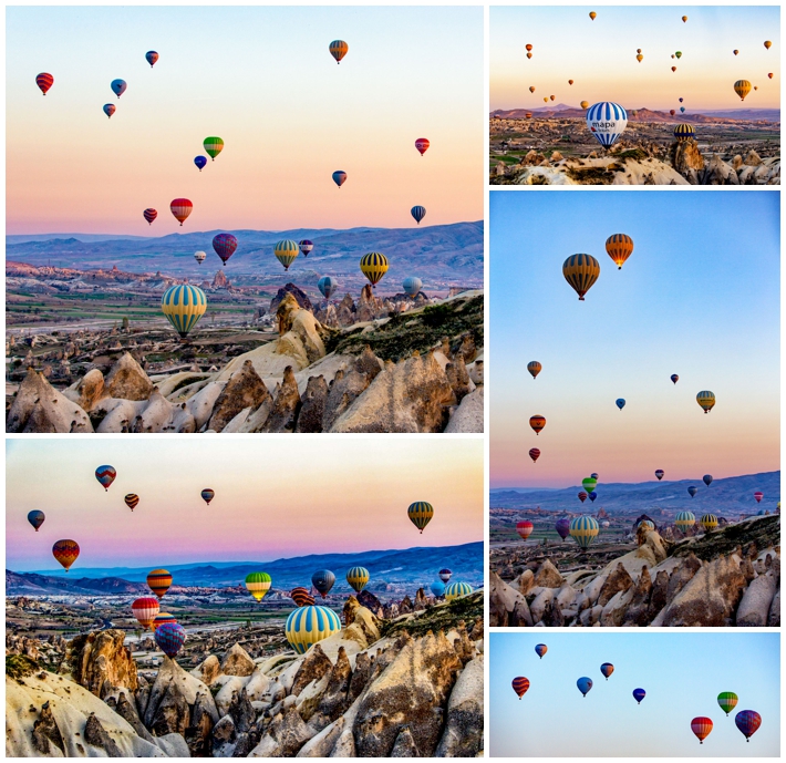
Most photos of Cappadocia show a scene of hot air balloons flying over the valley. Watching 30+ balloons all lift within minutes of each other, and then drift over the “sand dunes” (more on those later) and into the valley makes it clear why this is such a popular photography location.
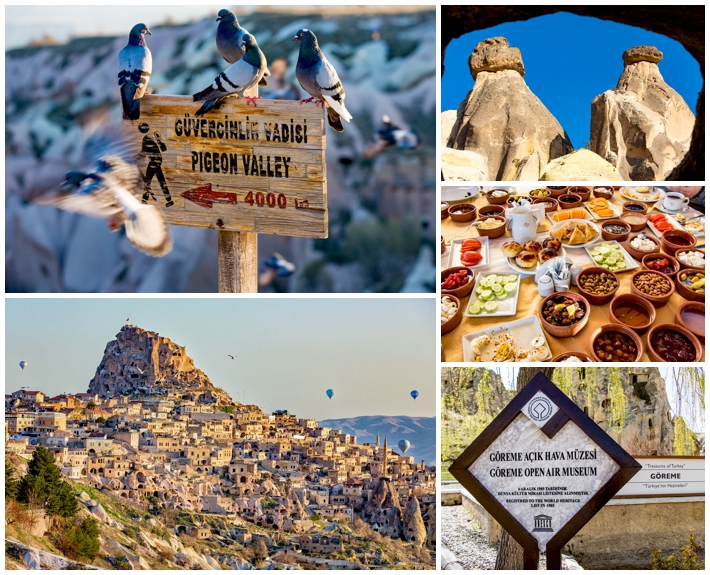
Our next stop was Pigeon Valley, so named because of the thousands of pigeons that call this place home. They were first brought here in the 4th century AD, and raised both for food and fertilizer, harvesting the bird droppings for crops. You can see Uchisar castle in the background, as well as a few hot air balloons still in the air.
Breakfast was yet another feast with more than 50 courses– nobody ever goes hungry on Mehmet’s photo tours! Then, on to the Göreme open air museum of cave dwellings. Unfortunately, photography was forbidden here, so I have no images to share of the frescoes.
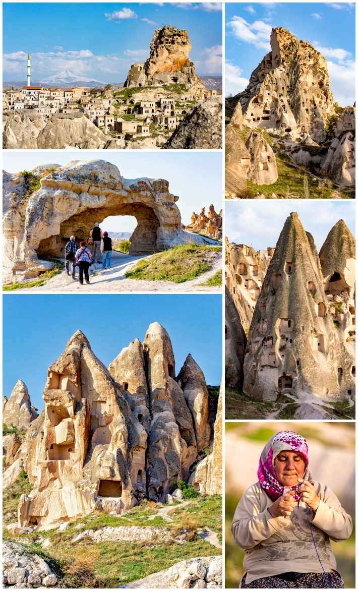
After lunch, we visited the “fairy castles.” These are limestone hills, that were occupied starting in the 6th century BC. Ortahisar castle is again seen in the background here, and Mehmet bribed one local vendor to pose for us.
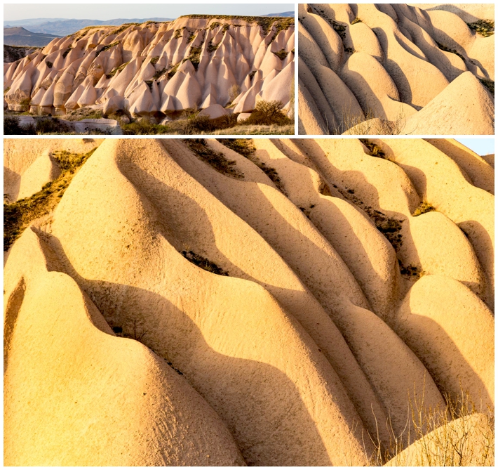
In the late afternoon, we drove to the “sand dunes” of the region. Actually, these are limestone formations that have eroded over the millennia until they looked very much like sand dunes. The low afternoon sun was optimal for creating deep shadows. The upper-left image shows the area from a wider view, letting you see the overall topography of the area, while the others zoom in for more abstract images.
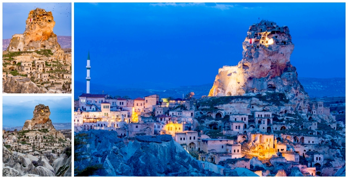
We waited for sunset in a small park overlooking the Uchisat Castle, followed by another scrumptious dinner at a restaurant where Mehmet knew the owner.